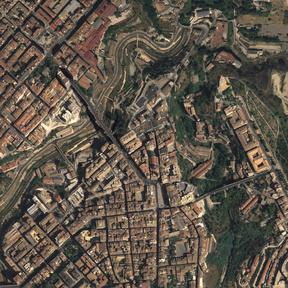
 CartoHistAlcoy
Type of resources
Available actions
Topics
Keywords
Contact for the resource
Provided by
Years
Formats
Representation types
Update frequencies
Resolution
-
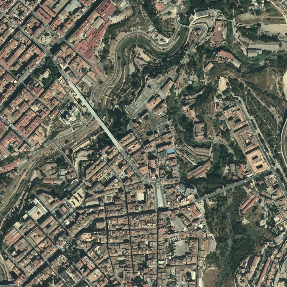
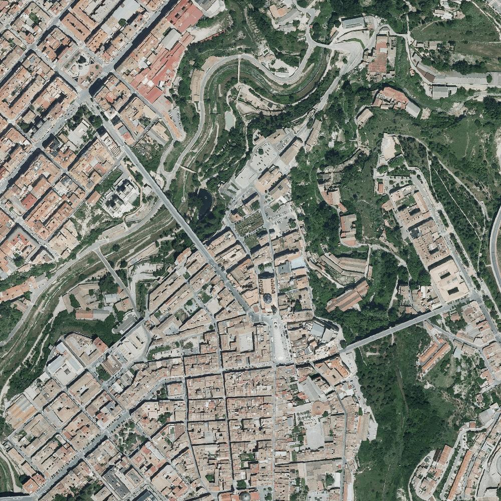
Natural color (RGB) orthophoto mosaic covering the Comunitat Valenciana at 25 cm resolution, based on the RGBI digital photogrammetric flight taken from 08/06/2017 to 23/08/2017. The orthophoto is distributed in 1:5.000 sheets, being accessible for download in ECW (RGB 3 bands) and TIFF(RGBI 4 bands). 8-bit color depth per band. ETRS89 geodetic reference system. UTM projection zone 30. Map service (wms and wmts) are available. The province of Alicante is transferred for its integration into the National Plan of Aerial Orthophotography of Spain (PNOA)
-
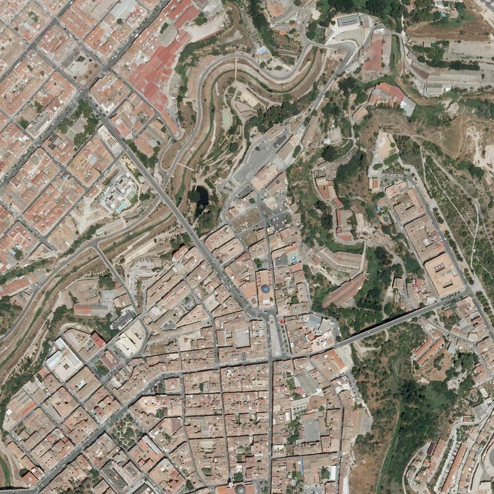
Natural color (RGB) orthophoto mosaic covering the Comunidad Valenciana at 50 cm resolution from a RGBI photogrammetric flight taken from 16/06/2012 to 28/28/2012. The orthophoto is distributed by 1:10.000 sheets, being accessible for download in ECW and TIFF (RGB 3 bands) format. 8-bit color depth per band. ETRS89 geodetic reference system. UTM projection zone 30. Map services (wms and wmts) are available. Integral product of the National Plan of Aerial Orthophotography of Spain (PNOA)
-
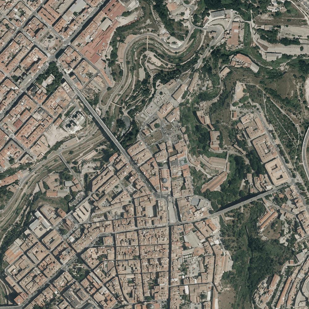
Natural color (RGB) orthophoto mosaic covering the Comunitat Valenciana, at 25 cm resolution, based on the RGBI digital photogrammetric flight taken from 13/06/2018 to 24/08/2018. The orthophoto is distributed in 1: 5.000 sheets, being accessible for download in ECW (RGB 3 bands) and TIFF (RGBI 4 bands). 8-bit depth color per band. ETRS89 geodetic reference system. UTM projection zone 30. Map services (wms and wmts) are available. Castellón and Valencia provinces are transferred for its integration into the National Plan of Aerial Orthophotography of Spain (PNOA)
-
Mosaic of orthophotos in natural color (RGB) and false infrared color (IRG) covering the province of Alicante at 50 cm resolution based on the RGBI digital photogrammetric flight (GSD 40 cm) taken from 23/08/2007 to 03/09/2007. The orthophoto is distributed by 1:10.000 sheets, being accessible for download in ECW and TIFF formats for both RGB and IRG (3-band) images. 8-bit color depth per band. ETRS89 geodetic reference system. UTM projection zone 30. Map services (wms and wmts) are available. Integral product of the National Plan of Aerial Orthophotography of Spain (PNOA)
-
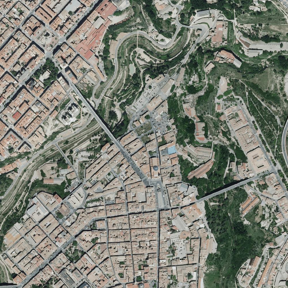
Natural color (RGBI) and false infrared color (IRG) orthophoto mosaic covering the Comunidad Valenciana, at 25 cm resolution, based on the RGBI digital photogrammetric flight taken from 02/05/2020 to 31/05/2020. The orthophoto is distributed by 1: 5.000 sheets, being accessible for download in ECW (RGB 3 bands) and TIFF (RGBI 4 bands). 8-bit color depth per band. ETRS89 geodetic reference system. UTM projection zone 30. Map services (wms and wmts) are available
-
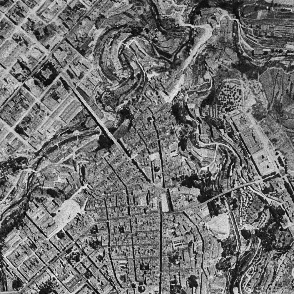
Digital grayscale orthophoto of the Valencian Community made at 50 cm resolution from the scanned photogrammetric flight dated on 1956-1957 (American series B) at flight scale 1:33.000 dated from 05/05/1956 till 08/01/1957. The orthophoto is distributed by sheets 1: 10,000, being accessible for download in ECW and TIFF format (PAN 1 band). 8-bit color depth per band. ETRS89 Geodetic reference system. UTM projection zone 30. Map services (wms and wmts) are available
-

Mosaic of orthophotos in natural color (RGB) and false infrared color (IRG) covering the Comunidad Valenciana, at 25 cm resolution, based on the RGBI digital photogrammetric flight taken from 13/05/2021 to 15/08/2021. The orthophoto is distributed by 1:5.000 sheets, being accessible for download in ECW (RGB 3-band) and TIFF format (RGBI 4-band) images. 8-bit color depth per band. ETRS89 geodetic reference system. UTM projection zone 30. Map services (wms and wmts) are available
-
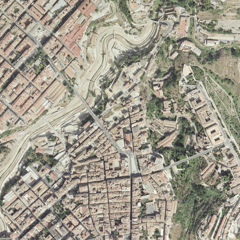
Natural color (RGB) orthophoto mosaic covering the Comunidad Valenciana, at 25 cm resolution, based on the RGBI digital photogrammetric flight taken from 14/05/2019 to 30/06/2019. The orthophoto is distributed by 1: 5.000 sheets, being accessible for download in ECW (RGB 3 bands) and TIFF (RGBI 4 bands). 8-bit color depth per band. ETRS89 geodetic reference system. UTM projection zone 30. Map services (wms and wmts) are available
-
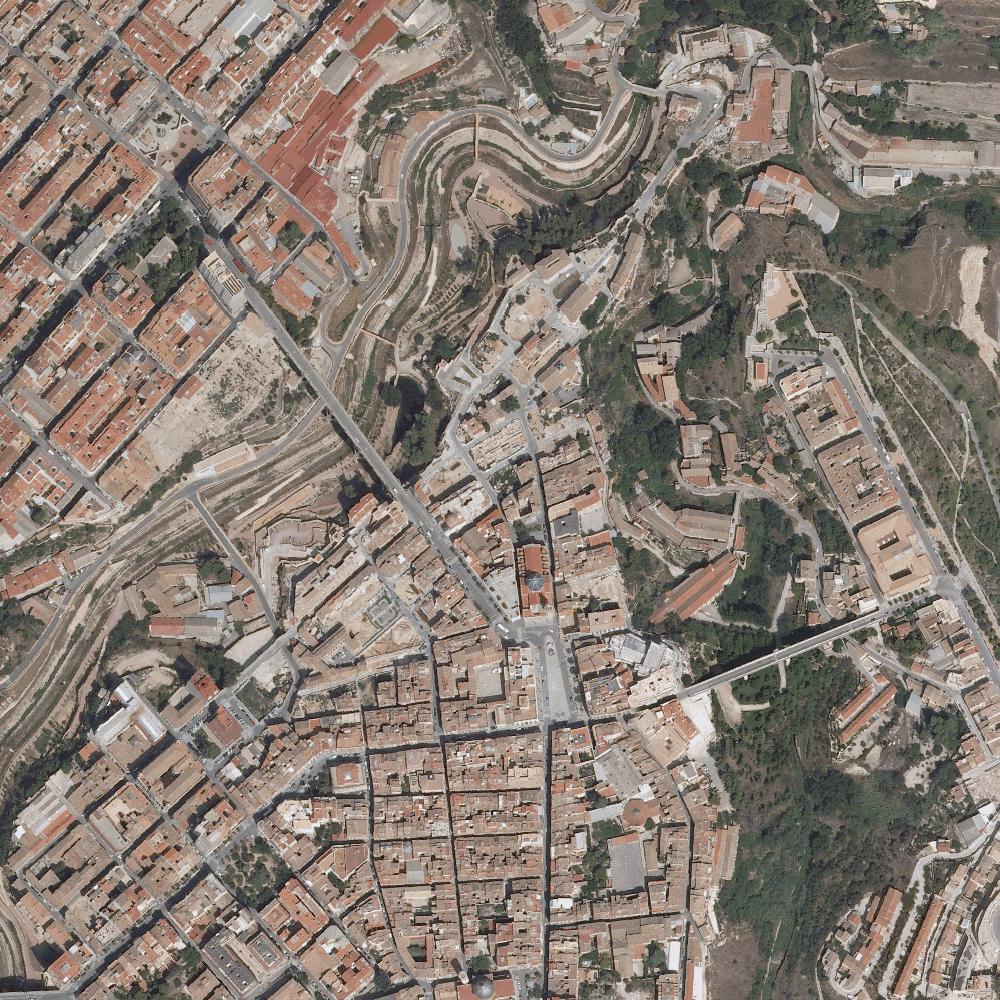
Natural color (RGB) orthophoto mosaic covering the entire province of Alicante at 50 cm resolution, based on the scanned RGB photogrammetric flight taken from 03/09/2005 to 11/05/2005. The orthophoto is distributed in 1: 10.000 sheets, being accessible for download in ECW and TIFF (RGB 3 bands) format. 8-bit color depth per band. ETRS89 geodetic reference system. UTM projection zone 30. Map services (wms and wmts) are available. Integral product of the National Plan of Aerial Orthophotography of Spain (PNOA)
-
Orthophoto mosaic (RGB) covering the province of Alicante, at 25 cm resolution, based on the digital photogrammetric flight (RGB) taken from 05/08/2009 to 25/09/2009. Orthophoto are distributed by 1:5.000 sheets, being accessible for download in ECW and TIF format (RGB -3 bands). Color capture bit depth is 8 bits. Geodetic reference system is ETRS89 according to UTM Projection coordinates Zone 30 North. Searchable as a map service (wms and wmts). Product belongs to the National Plan of Aerial Orthophotography of Spain (PNOA)